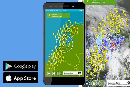
Dé onweeralarm app met nauwkeurige bliksemradar voor heel de wereld. Download hem nu in onderstaande store(s)!

![]()

...Locatie laden
Je hebt locatie-toegang geweigerd. Herstel dit in je browser en herlaad de pagina.
Favorieten
Eerder bekeken![]()

...Locatie laden
Je hebt locatie-toegang geweigerd. Herstel dit in je browser en herlaad de pagina.
Favorieten
Eerder bekeken![]()

Op de gewone satellietbeelden is een optimale combinatie te zien van het zichtbaar licht en het infrarood satellietbeeld. Overdag zijn op de satelliet zijn bewolkingsbeelden te zien zoals de wolken met het blote oog vanuit de ruimte te zien zijn, maar dan sterk ingezoomd. Tijdens de donkere uren van de dag wordt er geswitched naar de infrarood satellietbeelden, zodat je nog steeds kan zien waar het bewolkt is.
Op de gewone satellietbeelden is een optimale combinatie te zien van het zichtbaar licht en het infrarood satellietbeeld. Overdag zijn op de satelliet zijn bewolkingsbeelden te zien zoals de wolken met het blote oog vanuit de ruimte te zien zijn, maar dan sterk ingezoomd. Tijdens de donkere uren van de dag wordt er geswitched naar de infrarood satellietbeelden, zodat je nog steeds kan zien waar het bewolkt is.
Op de zichtbare satelliet zijn bewolkingsbeelden te zien zoals de wolken met het blote oog vanuit de ruimte te zien zijn, maar dan sterk ingezoomd. Je kijkt dus van bovenaf vanuit het heelal naar hoe de bewolking over de aarde heen trekt. De zichtbare satellietbeelden zijn tijdens de nacht niet bruikbaar, omdat de wolken dan niet meer beschenen worden door de zon.
Op de zichtbare satelliet zijn bewolkingsbeelden te zien zoals de wolken met het blote oog vanuit de ruimte te zien zijn, maar dan sterk ingezoomd. Je kijkt dus van bovenaf vanuit het heelal naar hoe de bewolking over de aarde heen trekt. De zichtbare satellietbeelden zijn tijdens de nacht niet bruikbaar, omdat de wolken dan niet meer beschenen worden door de zon.
Met de infrarood satellietbeelden kun je ook tijdens de donkere uren van de dag zien waar bewolking overtrekt en waar opklaringen voorkomen. Vooral hoge bewolking behorende bij weerfronten en felle buien zijn goed te onderscheiden op deze beelden. De wolken zijn in witte kleuren zichtbaar op de infraroodbeelden. Overdag zijn de infraroodbeelden minder goed bruikbaar, doordat het contrast dan afneemt.
Met de infrarood satellietbeelden kun je ook tijdens de donkere uren van de dag zien waar bewolking overtrekt en waar opklaringen voorkomen. Vooral hoge bewolking behorende bij weerfronten en felle buien zijn goed te onderscheiden op deze beelden. De wolken zijn in witte kleuren zichtbaar op de infraroodbeelden. Overdag zijn de infraroodbeelden minder goed bruikbaar, doordat het contrast dan afneemt.
Op de nacht microfysica satellietbeelden is tijdens de donkere uren van de nacht een goed onderscheid te maken tussen lage bewolking (gele kleuren), middelbare bewolking (roze kleuren) en hoge bewolking (rode kleuren). Zie je een blauwe kleur dan is er geen bewolking aanwezig en is het helder. Overdag zijn de microfyisca beelden minder goed bruikbaar, doordat alle bewolking roze tinten krijgt.
Op de nacht microfysica satellietbeelden is tijdens de donkere uren van de nacht een goed onderscheid te maken tussen lage bewolking (gele kleuren), middelbare bewolking (roze kleuren) en hoge bewolking (rode kleuren). Zie je een blauwe kleur dan is er geen bewolking aanwezig en is het helder. Overdag zijn de microfyisca beelden minder goed bruikbaar, doordat alle bewolking roze tinten krijgt.
Op dit satellietbeeld is een combinatie te zien van de satellietbeelden (zichtbaar en infrarood gecombineerd) en de neerslagradar. Hiermee zie je zowel de wolken als de neerslag aankomen.
Op dit satellietbeeld is een combinatie te zien van de satellietbeelden (zichtbaar en infrarood gecombineerd) en de neerslagradar. Hiermee zie je zowel de wolken als de neerslag aankomen.
Satellietbeelden afgelopen 2 uur
Satellietbeelden afgelopen 24 uur
Zichtbare satelliet vorige 2 uur
Zichtbare satelliet vorige 24 uur
Infrarood satelliet afgelopen 2 uur
Infrarood satelliet afgelopen 24 uur
Satelliet Nacht Microfysica vorige 2 uur
Satelliet Nacht Microfysica vorige 24 uur
Radar- en satellietbeelden afgelopen 2 uur
Radar- en satellietbeelden afgelopen 2 uur
14:10 woensdag, 17. apr.
Something went wrong with getting radar images
Satellietbeelden afgelopen 2 uur
Satellietbeelden afgelopen 24 uur
Zichtbare satelliet vorige 2 uur
Zichtbare satelliet vorige 24 uur
Infrarood satelliet afgelopen 2 uur
Infrarood satelliet afgelopen 24 uur
Satelliet Nacht Microfysica vorige 2 uur
Satelliet Nacht Microfysica vorige 24 uur
Radar- en satellietbeelden afgelopen 2 uur
Radar- en satellietbeelden afgelopen 2 uur
Op de gewone satellietbeelden is een optimale combinatie te zien van het zichtbaar licht en het infrarood satellietbeeld. Overdag zijn op de satelliet zijn bewolkingsbeelden te zien zoals de wolken met het blote oog vanuit de ruimte te zien zijn, maar dan sterk ingezoomd. Tijdens de donkere uren van de dag wordt er geswitched naar de infrarood satellietbeelden, zodat je nog steeds kan zien waar het bewolkt is.
Op de gewone satellietbeelden is een optimale combinatie te zien van het zichtbaar licht en het infrarood satellietbeeld. Overdag zijn op de satelliet zijn bewolkingsbeelden te zien zoals de wolken met het blote oog vanuit de ruimte te zien zijn, maar dan sterk ingezoomd. Tijdens de donkere uren van de dag wordt er geswitched naar de infrarood satellietbeelden, zodat je nog steeds kan zien waar het bewolkt is.
Op de zichtbare satelliet zijn bewolkingsbeelden te zien zoals de wolken met het blote oog vanuit de ruimte te zien zijn, maar dan sterk ingezoomd. Je kijkt dus van bovenaf vanuit het heelal naar hoe de bewolking over de aarde heen trekt. De zichtbare satellietbeelden zijn tijdens de nacht niet bruikbaar, omdat de wolken dan niet meer beschenen worden door de zon.
Op de zichtbare satelliet zijn bewolkingsbeelden te zien zoals de wolken met het blote oog vanuit de ruimte te zien zijn, maar dan sterk ingezoomd. Je kijkt dus van bovenaf vanuit het heelal naar hoe de bewolking over de aarde heen trekt. De zichtbare satellietbeelden zijn tijdens de nacht niet bruikbaar, omdat de wolken dan niet meer beschenen worden door de zon.
Met de infrarood satellietbeelden kun je ook tijdens de donkere uren van de dag zien waar bewolking overtrekt en waar opklaringen voorkomen. Vooral hoge bewolking behorende bij weerfronten en felle buien zijn goed te onderscheiden op deze beelden. De wolken zijn in witte kleuren zichtbaar op de infraroodbeelden. Overdag zijn de infraroodbeelden minder goed bruikbaar, doordat het contrast dan afneemt.
Met de infrarood satellietbeelden kun je ook tijdens de donkere uren van de dag zien waar bewolking overtrekt en waar opklaringen voorkomen. Vooral hoge bewolking behorende bij weerfronten en felle buien zijn goed te onderscheiden op deze beelden. De wolken zijn in witte kleuren zichtbaar op de infraroodbeelden. Overdag zijn de infraroodbeelden minder goed bruikbaar, doordat het contrast dan afneemt.
Op de nacht microfysica satellietbeelden is tijdens de donkere uren van de nacht een goed onderscheid te maken tussen lage bewolking (gele kleuren), middelbare bewolking (roze kleuren) en hoge bewolking (rode kleuren). Zie je een blauwe kleur dan is er geen bewolking aanwezig en is het helder. Overdag zijn de microfyisca beelden minder goed bruikbaar, doordat alle bewolking roze tinten krijgt.
Op de nacht microfysica satellietbeelden is tijdens de donkere uren van de nacht een goed onderscheid te maken tussen lage bewolking (gele kleuren), middelbare bewolking (roze kleuren) en hoge bewolking (rode kleuren). Zie je een blauwe kleur dan is er geen bewolking aanwezig en is het helder. Overdag zijn de microfyisca beelden minder goed bruikbaar, doordat alle bewolking roze tinten krijgt.
Op dit satellietbeeld is een combinatie te zien van de satellietbeelden (zichtbaar en infrarood gecombineerd) en de neerslagradar. Hiermee zie je zowel de wolken als de neerslag aankomen.
Op dit satellietbeeld is een combinatie te zien van de satellietbeelden (zichtbaar en infrarood gecombineerd) en de neerslagradar. Hiermee zie je zowel de wolken als de neerslag aankomen.
Zon Amsterdam
donderdag
18 apr4° / 12°
vrijdag
19 apr7° / 11°
Dé onweeralarm app met nauwkeurige bliksemradar voor heel de wereld. Download hem nu in onderstaande store(s)!
![]()
Op de gewone satellietbeelden is een optimale combinatie te zien van het zichtbaar licht en het infrarood satellietbeeld. Overdag zijn op de satelliet zijn bewolkingsbeelden te zien zoals de wolken met het blote oog vanuit de ruimte te zien zijn, maar dan sterk ingezoomd. Tijdens de donkere uren van de dag wordt er geswitched naar de infrarood satellietbeelden, zodat je nog steeds kan zien waar het bewolkt is.
Op de gewone satellietbeelden is een optimale combinatie te zien van het zichtbaar licht en het infrarood satellietbeeld. Overdag zijn op de satelliet zijn bewolkingsbeelden te zien zoals de wolken met het blote oog vanuit de ruimte te zien zijn, maar dan sterk ingezoomd. Tijdens de donkere uren van de dag wordt er geswitched naar de infrarood satellietbeelden, zodat je nog steeds kan zien waar het bewolkt is.
Op de zichtbare satelliet zijn bewolkingsbeelden te zien zoals de wolken met het blote oog vanuit de ruimte te zien zijn, maar dan sterk ingezoomd. Je kijkt dus van bovenaf vanuit het heelal naar hoe de bewolking over de aarde heen trekt. De zichtbare satellietbeelden zijn tijdens de nacht niet bruikbaar, omdat de wolken dan niet meer beschenen worden door de zon.
Op de zichtbare satelliet zijn bewolkingsbeelden te zien zoals de wolken met het blote oog vanuit de ruimte te zien zijn, maar dan sterk ingezoomd. Je kijkt dus van bovenaf vanuit het heelal naar hoe de bewolking over de aarde heen trekt. De zichtbare satellietbeelden zijn tijdens de nacht niet bruikbaar, omdat de wolken dan niet meer beschenen worden door de zon.
Met de infrarood satellietbeelden kun je ook tijdens de donkere uren van de dag zien waar bewolking overtrekt en waar opklaringen voorkomen. Vooral hoge bewolking behorende bij weerfronten en felle buien zijn goed te onderscheiden op deze beelden. De wolken zijn in witte kleuren zichtbaar op de infraroodbeelden. Overdag zijn de infraroodbeelden minder goed bruikbaar, doordat het contrast dan afneemt.
Met de infrarood satellietbeelden kun je ook tijdens de donkere uren van de dag zien waar bewolking overtrekt en waar opklaringen voorkomen. Vooral hoge bewolking behorende bij weerfronten en felle buien zijn goed te onderscheiden op deze beelden. De wolken zijn in witte kleuren zichtbaar op de infraroodbeelden. Overdag zijn de infraroodbeelden minder goed bruikbaar, doordat het contrast dan afneemt.
Op de nacht microfysica satellietbeelden is tijdens de donkere uren van de nacht een goed onderscheid te maken tussen lage bewolking (gele kleuren), middelbare bewolking (roze kleuren) en hoge bewolking (rode kleuren). Zie je een blauwe kleur dan is er geen bewolking aanwezig en is het helder. Overdag zijn de microfyisca beelden minder goed bruikbaar, doordat alle bewolking roze tinten krijgt.
Op de nacht microfysica satellietbeelden is tijdens de donkere uren van de nacht een goed onderscheid te maken tussen lage bewolking (gele kleuren), middelbare bewolking (roze kleuren) en hoge bewolking (rode kleuren). Zie je een blauwe kleur dan is er geen bewolking aanwezig en is het helder. Overdag zijn de microfyisca beelden minder goed bruikbaar, doordat alle bewolking roze tinten krijgt.
Op dit satellietbeeld is een combinatie te zien van de satellietbeelden (zichtbaar en infrarood gecombineerd) en de neerslagradar. Hiermee zie je zowel de wolken als de neerslag aankomen.
Op dit satellietbeeld is een combinatie te zien van de satellietbeelden (zichtbaar en infrarood gecombineerd) en de neerslagradar. Hiermee zie je zowel de wolken als de neerslag aankomen.
Satellietbeelden afgelopen 2 uur
Satellietbeelden afgelopen 24 uur
Zichtbare satelliet vorige 2 uur
Zichtbare satelliet vorige 24 uur
Infrarood satelliet afgelopen 2 uur
Infrarood satelliet afgelopen 24 uur
Satelliet Nacht Microfysica vorige 2 uur
Satelliet Nacht Microfysica vorige 24 uur
Radar- en satellietbeelden afgelopen 2 uur
Radar- en satellietbeelden afgelopen 2 uur
14:10 woensdag, 17. apr.
Something went wrong with getting radar images
Satellietbeelden afgelopen 2 uur
Satellietbeelden afgelopen 24 uur
Zichtbare satelliet vorige 2 uur
Zichtbare satelliet vorige 24 uur
Infrarood satelliet afgelopen 2 uur
Infrarood satelliet afgelopen 24 uur
Satelliet Nacht Microfysica vorige 2 uur
Satelliet Nacht Microfysica vorige 24 uur
Radar- en satellietbeelden afgelopen 2 uur
Radar- en satellietbeelden afgelopen 2 uur
Op de gewone satellietbeelden is een optimale combinatie te zien van het zichtbaar licht en het infrarood satellietbeeld. Overdag zijn op de satelliet zijn bewolkingsbeelden te zien zoals de wolken met het blote oog vanuit de ruimte te zien zijn, maar dan sterk ingezoomd. Tijdens de donkere uren van de dag wordt er geswitched naar de infrarood satellietbeelden, zodat je nog steeds kan zien waar het bewolkt is.
Op de gewone satellietbeelden is een optimale combinatie te zien van het zichtbaar licht en het infrarood satellietbeeld. Overdag zijn op de satelliet zijn bewolkingsbeelden te zien zoals de wolken met het blote oog vanuit de ruimte te zien zijn, maar dan sterk ingezoomd. Tijdens de donkere uren van de dag wordt er geswitched naar de infrarood satellietbeelden, zodat je nog steeds kan zien waar het bewolkt is.
Op de zichtbare satelliet zijn bewolkingsbeelden te zien zoals de wolken met het blote oog vanuit de ruimte te zien zijn, maar dan sterk ingezoomd. Je kijkt dus van bovenaf vanuit het heelal naar hoe de bewolking over de aarde heen trekt. De zichtbare satellietbeelden zijn tijdens de nacht niet bruikbaar, omdat de wolken dan niet meer beschenen worden door de zon.
Op de zichtbare satelliet zijn bewolkingsbeelden te zien zoals de wolken met het blote oog vanuit de ruimte te zien zijn, maar dan sterk ingezoomd. Je kijkt dus van bovenaf vanuit het heelal naar hoe de bewolking over de aarde heen trekt. De zichtbare satellietbeelden zijn tijdens de nacht niet bruikbaar, omdat de wolken dan niet meer beschenen worden door de zon.
Met de infrarood satellietbeelden kun je ook tijdens de donkere uren van de dag zien waar bewolking overtrekt en waar opklaringen voorkomen. Vooral hoge bewolking behorende bij weerfronten en felle buien zijn goed te onderscheiden op deze beelden. De wolken zijn in witte kleuren zichtbaar op de infraroodbeelden. Overdag zijn de infraroodbeelden minder goed bruikbaar, doordat het contrast dan afneemt.
Met de infrarood satellietbeelden kun je ook tijdens de donkere uren van de dag zien waar bewolking overtrekt en waar opklaringen voorkomen. Vooral hoge bewolking behorende bij weerfronten en felle buien zijn goed te onderscheiden op deze beelden. De wolken zijn in witte kleuren zichtbaar op de infraroodbeelden. Overdag zijn de infraroodbeelden minder goed bruikbaar, doordat het contrast dan afneemt.
Op de nacht microfysica satellietbeelden is tijdens de donkere uren van de nacht een goed onderscheid te maken tussen lage bewolking (gele kleuren), middelbare bewolking (roze kleuren) en hoge bewolking (rode kleuren). Zie je een blauwe kleur dan is er geen bewolking aanwezig en is het helder. Overdag zijn de microfyisca beelden minder goed bruikbaar, doordat alle bewolking roze tinten krijgt.
Op de nacht microfysica satellietbeelden is tijdens de donkere uren van de nacht een goed onderscheid te maken tussen lage bewolking (gele kleuren), middelbare bewolking (roze kleuren) en hoge bewolking (rode kleuren). Zie je een blauwe kleur dan is er geen bewolking aanwezig en is het helder. Overdag zijn de microfyisca beelden minder goed bruikbaar, doordat alle bewolking roze tinten krijgt.
Op dit satellietbeeld is een combinatie te zien van de satellietbeelden (zichtbaar en infrarood gecombineerd) en de neerslagradar. Hiermee zie je zowel de wolken als de neerslag aankomen.
Op dit satellietbeeld is een combinatie te zien van de satellietbeelden (zichtbaar en infrarood gecombineerd) en de neerslagradar. Hiermee zie je zowel de wolken als de neerslag aankomen.